
A lake in Russia that is colored red on Google Maps is causing a stir online. It is not the only one of its kind. The reasons for the coloring are different.

This lake, colored red on Google Maps, is causing a stir on the internet. (Source: Google Maps, CNES, Maxar, Airbus Technologies, Landsat, Copernicus, map data)
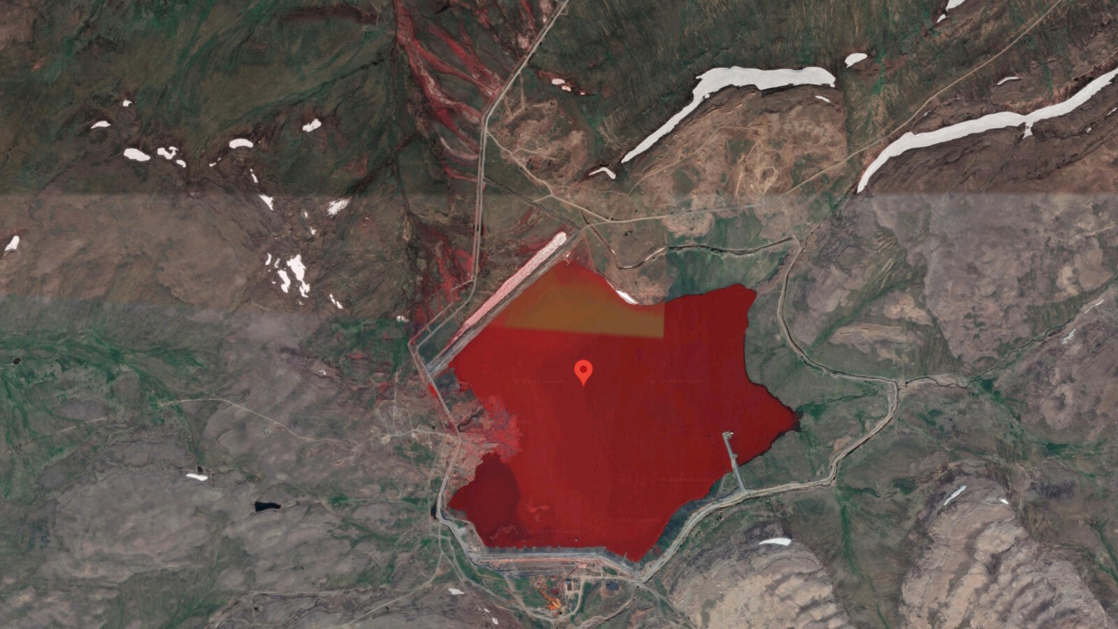
- Reddit users have discovered a red-colored lake in Russia on satellite images on Google Maps.
- Now they are puzzling over the cause.
- It’s not the only lake of this type.
Google Maps shows a red colored lake in Russia. What’s it all about? Is this just a bug in the map service (after all, satellite images can be deceiving) or is there more to it?
On Reddit became a thread on the subject commented and liked diligently in the last few days. Do you want to get your own picture of the red lake? Then you have to enter the following coordinates in Google Maps: 69.241772, 87.801488. And then activate the satellite view.

picture series
Google Maps Mysteries: What’s Really Behind These Satellite Images
Google Maps Mysteries: What’s Really Behind These Satellite Images
The mystery hasn’t really been solved yet. In the comments, however, the view prevails that the lake is probably a kind of tailings pond in which waste from mining is stored. Since the region is characterized by industry, this assumption is not unreasonable. Especially since there are similar examples.
Not the only lake of its kind
In 2016, images circulated online showing a blood-red river near the Russian city of Norilsk. Here, too, experts suspected the discharge of “mine waste” to be the cause.
The situation is different with Lake Burlinskoye in Siberia. It turns pink every summer.
Responsible for this is the Siberian Times according to a tiny crab that lives in the lake. It secretes a unique pink pigment that lightens in dry and warm weather.
Also interesting…
In the meantime, however, other Google Maps mysteries have been cleared up – such as the giant blows in France or the black hole in the desert.
Don’t miss anything with the NETWORK-Newsletter
Every Friday: The most informative and entertaining summary from the world of technology!